Watson's Crag, Snowy Mountains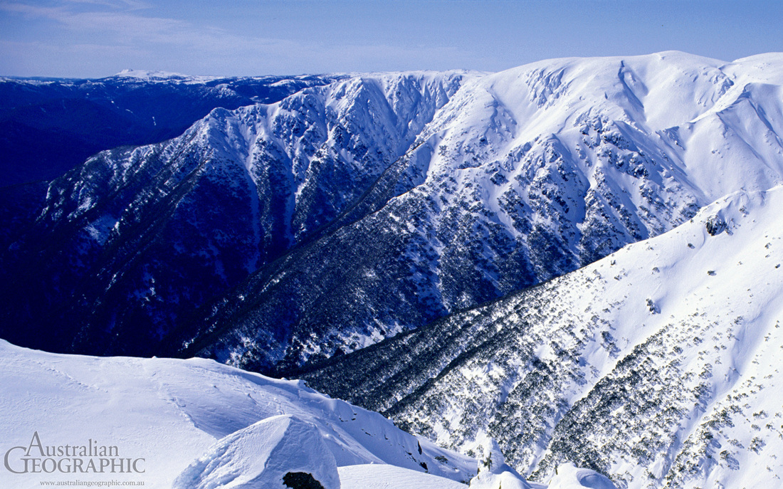
Landform Regions in Australia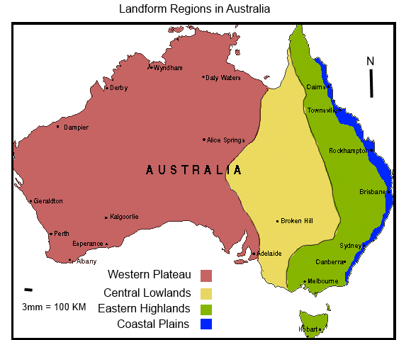
|
Landform Regions Australia can be divided into four major landform regions. These being: Eastern Highlands, Western Plateau, Coastal Plains and the Central Lowlands. These landform regions have been created by movements in the crust of the earth.
The Western Plateau is one third of the Australian continent, it takes up an area of 2, 700, 000 square kilometers and is the largest of all the landform regions. The Western Plateau contains some iconic Australian natural formations, such as Uluru and Kata Tjuta. The Eastern Highlands comprises the area commonly known as the Great Dividing Range. It is only 10% of Australia, and is 3, 500 km long from Cape York Peninsula to Tasmania. The Eastern Highlands is the most fertile region and is the result of Plate Tectonics. The Coastal Plains extend along the Eastern Edge of the continent; they start in Queensland and end in Victoria. It is the most densely populated region of the four. The Coastal Plains are the low lying area directly adjacent to the eastern coast. The Central Lowlands incorporate one quarter of the total landmass. It is a low lying, featureless area of the continent, and is an average of 200m above sea level. It has very dry, arid to semi-arid conditions, and although it is quite flat, it does have some mountains. The only feature is Lake Eyre, which is 15m below sea level, and is 10,000 km squared. The MapThis map demonstrates the landform regions of Australia. As
can be seen, the Western Plateau is by far the largest region of the country,
followed by the Central Lowlands, Eastern Highlands and Coastal Plains. The
Western Plateau is very dry, and mostly desert. There are a few points of
interest here, such as; The Great Sandy and Victoria Deserts, Uluru, Kata Tjuta
and Kings Canyon. The Central Lowlands has almost nothing of interest, except
for Flinders Range, and parts of the Great Artesian Basin. The Eastern
Highlands contain many rugged valleys and gorges, and has a high elevation. The
Eastern Highlands house the majority of the Great Dividing Range, and the Snowy
Mountains. The blue area in the above map, the Coastal Plains, is the most
densely populated region of Australia. The Coastal Plains are separated from
the rest of the continent by the Great Dividing Range, and are directly
affected by the ocean.
|
